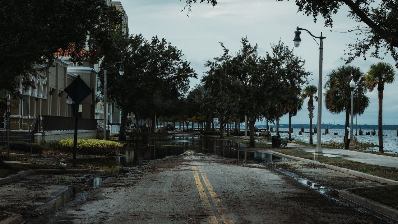
The St. Johns River broke its all-time flood record on Friday morning. At 6:15 a.m., the river reached 18.66 feet — a full foot above the previous record of 17.6 feet, set in 1953. The water has spilled over its banks into surrounding neighborhoods, and forecasters say the worst may not be over.
It is the second flood emergency on the Space Coast in less than three weeks, in the middle of one of the busiest travel weeks of the year. More than 100 people were rescued from floodwater in Brevard County on Thursday alone. About 65 homes in the Palm Bay Estates mobile home park were placed under a mandatory evacuation order after a bridge washed out and cut off the only road in. Shelters are open in Cocoa and Melbourne, and Florida Governor Ron DeSantis activated the National Guard on Thursday, sending hundreds of members, 50 high-water vehicles, airboats and swamp buggies into the county.
The rain behind it has been relentless. Cocoa Beach and Merritt Island have picked up more than 14 inches since Tuesday. Central Brevard County has already seen around 10 inches. Daytona Beach has collected more than 13 inches this week — more than four months' worth of rain in a matter of days. The National Weather Service has put the coast from Daytona Beach south to Rockledge under its highest flash flood risk, Level 4 of 4, meaning flash flooding is expected, not just possible. Another 3 to 6 inches are forecast for Friday across the Space Coast and northeast Florida, with some spots possibly getting 8 to 12 inches more. In the hardest-hit areas, totals could pass two feet by Saturday.
The ground cannot take any more. “Our soils are completely saturated. So any additional rainfall: the rain doesn't have anywhere to go,” National Weather Service meteorologist Melissa Watson told reporters on Friday morning. “So that's going to exacerbate the flooding that's already ongoing.”
THE STORY SO FAR
November 1–2: A historic 1-in-1,000-year rain event dumps up to two feet of rain on parts of South Brevard in two days. Two people are killed, more than 150 are rescued, and homes across the county are badly damaged.
Tuesday, November 17: The rain returns. A slow-moving storm parks off Florida's Atlantic coast and starts dropping heavy rain from Miami to Jacksonville, with the Space Coast taking the worst of it.
Wednesday, November 18: Governor DeSantis expands his state of emergency order for the November 2 flooding to include Brevard and 20 other counties, in advance of the next deluge. By the end of the day, Cocoa Beach and Merritt Island are already past a foot of rain since Tuesday.
Thursday, November 19: Overnight, another 6 to 8 inches fall on already-swamped parts of Brevard. First responders rescue more than 100 people. Sixty-five homes in Palm Bay Estates are evacuated after a bridge washes out. The National Guard is activated. Water managers open the S-96 levee, releasing St. Johns River water east toward the Indian River Lagoon for the first time since 2017.
Friday, November 20, 6:15 a.m.: The St. Johns River hits 18.66 feet, breaking the 1953 record. State Road A1A is closed and flooded near Patrick Space Force Base. State Road 46 is closed between Mims and Sanford. Kennedy Space Center closes its north and south gates, and a tornado warning is issued for the space center just after 7:25 a.m. The long-running Space Coast Marathon is canceled because Cocoa and Rockledge cannot spare the police and fire crews needed to support it.
WHAT HAPPENS NEXT
More rain is coming first. The National Weather Service expects another 2 to 6 inches across East-Central Florida on Friday, with the heaviest totals near the Brevard–Volusia county line. A flood watch stays in effect until 7 p.m. Friday, and a high surf advisory runs until Saturday evening, with waves reaching 12 feet.
Then the storm itself heads north. The offshore low-pressure system is expected to lift along the East Coast through the weekend and into Monday, and forecasters say it could become Tropical Storm Kyle — or a subtropical storm — as it moves. Either way, it threatens pre-Thanksgiving travel with gusty winds, rain and coastal flooding along the Southeast, Mid-Atlantic and New England coasts.
Back in Brevard, the cleanup will take weeks. U.S. Representative Mike Haridopolos said on Thursday night that he has spoken with FEMA Administrator Cameron Hamilton about individual relief, and is pushing for a faster timeline than the usual 30 to 60 days. Many of the people flooded out did not buy flood insurance, he said, because their homes are not in a mapped flood zone. County officials are urging victims to photograph their damage and apply for FEMA funding now, while the water is still being documented.
YOUR QUESTIONS, ANSWERED
Is the Space Coast Marathon canceled? Yes. Organizers canceled it because Cocoa and Rockledge could not spare the police and fire crews needed to support it during the emergency.
Are schools closed? Yes. Brevard County public schools are closed until after Thanksgiving, and Broward County and Palm Beach County schools were also closed on Friday because of the expected weather.
Is it safe to drive on the Space Coast right now? County emergency officials say no — stay home and off the roads if possible. State Road A1A is closed and flooded near Patrick Space Force Base, State Road 46 is closed between Mims and Sanford, and stretches of major roads from Satellite Beach inland are impassable.
Is this the same storm that flooded South Florida earlier in the week? It is the same slow-moving system. Nearly 17 inches of rain fell on South Florida earlier in the week, closing schools and stranding drivers there, and the same storm then hammered the Space Coast. MythPost covered that first wave on November 19.
Will the river keep rising? The St. Johns is a slow-moving river, and water managers have started releasing some of it east toward the Indian River Lagoon to ease the pressure. But with several more inches forecast and the ground already saturated, officials expect the flooding to remain a multiday event through the weekend.